
Renewal Study for the Rybářská Area
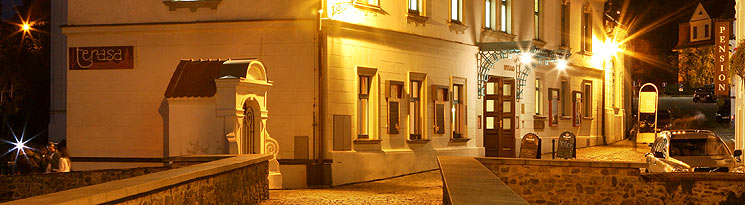
The Rybářská street location and close vicinity are on a very exposed place just under the Castle Supply Gardens area on the left riverside of the Vltava River. Along with the footpath on the adjacent slope, it has always been a part of the historical center of Český Krumlov. When the town entered the UNESCO register of worldly significant cultural monuments, the importance of reconstructing this old part of the city was greatly increased. A group of specialists from various fields undertook to complete that task, and developed the Renewal Study for the entire location. Projects for separate activities have been worked out as well.

In addition to the Gothic masonry on one of the Rybářská street structures, 12 Baroque style and 15 Renaissance style house constructions were identified during the course of historical-constructional research. Further research showed that some of the structures were used directly in conjunction with the mining equipment for graphite extraction. Eventually, an all-embracing reconstruction and finishing of buildings will be performed on the basis of architectonic studies and with the help of contemporary photographs, plans, maps and other archival material of the Location. Apart from residences, the buildings should serve for small services to customers, refreshment, expositions, handicrafts, etc. Landing docks constructed on the river will offer the possibility for water sports lovers or fishers to tie their boats, and in the same time to rest in a congenial atmosphere and take refreshments. The narrow space of Rybářská street would be in this interesting way enlarged and connected, with scenic beauty, with the life on the river. Particularly in the summertime, the entire space will create a nice relaxation and recreation area in the old city. It will also complete, in an important way, the panorama of the town, visible from the Castle Gardens in Český Krumlov.

The adjacent slope above Rybářská street was, in the beginning of the 19th century, freely accessible thanks to a panoramic footpath. It became a favorite destination of romantic strolls and for seigniorial and middle class walks. The implementation of that path to the rugged natural environment is well evident on a city map dated 1826 as well as on old historical pictures of the town.

During the course of detailed research on the slope, it was revealed that fragments of the footpath and panoramic view areas are still evidently visible. Through a renovation of this historically documented promenade path, surprising and completely new views onto the old city center will be opened up from certain places on the slope. The complete view would embrace the unique architectonic and artistic value of the town, side by side with the natural frame of the meander of the Vltava river forming an unequaled unity appropriate for monuments of world significant cultural heritage. The original Gothic ground plan of the town with the predominating Renaissance - Baroque style material composition of petite middle class architecture, the monumental Castle mass perched on the craggy tong of rock above the river located on one side, and the magnificent dignity of the sacred architecture of the Church of St. Vitus on the other side; all this will be available there for admiration from an adequate height.

Along with the Rybářská street renovation and the panoramic footpath revival, the question of adjacent slope safety needs to be solved. These serious circumstances were recognized during the research, and they prevent any immediate initiation of restoration and residential construction. The slope above Rybářská street is a rush riverside of the Vltava with traces of rocky river terraces and is quite steep. The unfavorably inclined areas, due to the disconjunction of craggy metamorphosis complex, include areas of intensified graphite content in places. This along with the naturally weathered and loosening rocky massif leads to the very dangerous possibility of rocks crashing down. It is much less dangerous to climb slowly down the surface formations on precipitate bedrock. The redevelopment of those places, together with the usage of the planned panoramic footpath as a stabilizing element, is then the first condition in a renewal of the entire location.

The forest-gardening landscaping will be similarly a stabilizing element. The main task here will be to protect the slope from the impact of wind and water erosion and destruction of the bedrock. There will be a significant change of slope vegetation as regards their planned usage in the context of the entire slope. The biological regularity will be respected, as will the requests of the city-planning specialists, specialists of heritage authorities, and ecologists.
When the entire complex is finally completed, only then will the footpath be equipped with educational stop marks of a natural scientific, mining, historical and architectonic content. In this way the town can gain a new harmonizing unity with a high practical and esthetic value, which is undoubtedly a contribution for local citizens and for the development of travel and tourism.
(sch)